Our field coordinators are forced to take a break for a week: on the one hand they are a bit ill (neither Covid nor Ebola, thanks God!), on the other hand the end of Ramadan festivities absorb all the energies in the villages and it is useless to continue our efforts. Let’s use this short break to answer this question: What is the link between satellite imagery and deforestation? There is a lot of buzz about Space these days, but is it really useful to send people and objects over our heads? The answer is clearly yes for the Sentinel satellites that are used for environmental observations.
Two examples of research carried out by CIRAD (Centre International de Recherche Agronomique pour le Développement) using (free!) data from the Sentinel 2 satellite:
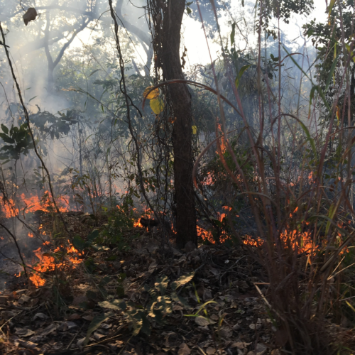
Mapping the impact of vegetation fires in tropical Africa (article). The satellite images (which reflect 92% of the reality on the ground!) show that vegetation fires have caused the burning of 5,878 km2 of vegetation cover, i.e. 10.39% of the national territory of Togo. Utilitarian fires represent 22% against 78% for uncontrolled fires.
Some regions are more affected by fires: “In Togo, utilitarian fires are common for cleaning fields, pastoralism and straw renewal […] they often escape human control, gain ground and become uncontrolled fires […] Regionally, the Kara region and the Savanes region remain the most exposed to fires. This could be explained by the severity of the dry season in the northern regions and also by the structure and composition of the landscape.”
The satellite images also allow the identification of affected vegetation types: “The results reveal that savannahs, crops and fallows are the most impacted […]. The high percentages of these formations burnt can be explained by the fact that they contain a lot of grass. ”
Impact of cash crops on the forest (article): In Côte d’Ivoire, almost two-thirds of the forest cover has disappeared since 1990 (!) with a significant loss of biodiversity. Thanks to satellite images, it is possible to assess changes in land use and occupation, in particular the dynamics of deforestation and forest degradation.
The comparison between the sky views of 2016 and 2019 shows that the expansion of cash crops (cocoa, rubber and oil palm), undifferentiated crops and fallows as well as infrastructure has led to a deforestation rate of almost 5% per year (!).
It can be observed that it is particularly the protected forests that suffer: “To avoid detection within the classified forests, cocoa farmers destroy as little as possible of the existing vegetation during the first years of setting up a farm. As seedlings develop, large trees are gradually devitalized by fire to meet the increasing light requirements of young cocoa trees. Within just a few years, the initial dense forests are rapidly degraded and quickly converted to pure cocoa plantations. ”
These lessons also apply to Guinea, where farming practices are similar to those in neighbouring countries. At arboRise we intend to use these free satellite sources to measure the impact of our reforestation and to see the Linko region greening up before our eyes. You can see it with us: here is the satellite view of our action area as of 31 December 2020.

